
Is Bali Affected by the Kalimantan Haze? What I Checked Before Writing This
By Gede Redika · October 19, 2026 · 9 min read
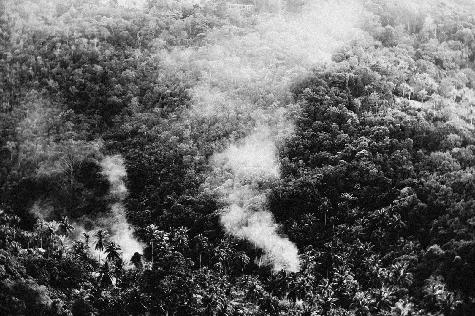
Photo by Alexey Demidov on Pexels
I'll be honest, the news out of Kalimantan and Sumatra this month has been hard to watch. Orange skies, hundreds of thousands of hectares gone, neighboring countries issuing air quality alerts. It worries me, and not just as someone who runs a trekking business here. Those are still our islands, our people dealing with it. So when guests started messaging to ask whether any of this reaches Bali, whether their sunrise trek is still a good idea, I didn't want to give them a quick "don't worry, we're fine" answer just to keep a booking. I wanted to actually check, the same way BMKG and the regional haze monitors check, before I told anyone anything.
What's actually happening right now
This year's haze is real and it is serious, and it deserves to be treated that way rather than waved off. The independent monitor Nusantara Atlas estimated at least 1.47 million hectares burned nationwide by September, roughly the size of Timor-Leste, and The Jakarta Post reported on October 19 that wildfire footage shows skies turning orange across Sumatra, Kalimantan and Papua, with the government facing criticism at home and abroad over how slowly it has responded.
BMKG, Indonesia's own weather agency, recorded 1,297 high-confidence hotspots nationwide as of October 14: Sumatra (505), Kalimantan (346), Papua and Maluku (330), Sulawesi (66), Nusa Tenggara (38) and Java (12). Himawari satellite imagery from October 15 showed smoke spreading over most of Sumatra, Kalimantan, Sulawesi, Maluku and Papua. I read that list twice looking for Bali in it. It isn't named, and neither is it in the latest update from ASEAN's regional haze monitor, the ASMC, which reports moderate to dense smoke haze over parts of Peninsular Malaysia, Singapore, Kalimantan, Sumatra and western Sarawak, plus Papua and the Maluku Islands, with air quality in Borneo and Sumatra at unhealthy to hazardous levels.
It's crossing borders too. Singapore recorded a 24-hour PSI of 230 in its western region on October 18, and Malaysia's worst reading nationwide, an API of 194 in Klang, Selangor, came on October 15, according to this round-up of the region's haze outlook. All of it traces back to an extended dry season tied to a strong El Niño pattern, the same pattern that's pushing back the start of Bali's own rainy season this year.
Putting the numbers in context
It's worth knowing what these figures actually mean, because "PSI 230" or "AQI 118" doesn't mean much on its own. Singapore and Malaysia use a PSI or API scale where 0–50 is good, 51–100 moderate, 101–200 unhealthy, 201–300 very unhealthy, and above 300 hazardous. Indonesia and most international trackers use the US AQI scale instead: 0–50 good, 51–100 moderate, 101–150 unhealthy for sensitive groups, 151–200 unhealthy, 201–300 very unhealthy, 301+ hazardous. So Singapore's 230 on October 18 is already in very unhealthy territory, and stations in Borneo and Sumatra have been reporting hazardous levels. That's the scale I kept in mind when I looked at Bali's own numbers below.
Why Bali isn't on that list
Two things explain it, and neither is luck. First, distance: Bali sits roughly 600 to 750 kilometers from the nearest fire areas in southern Kalimantan, and more than 1,000 kilometers from Sumatra's. Second, wind: the ASMC forecasts this season's prevailing winds over the southern ASEAN region blowing mainly from the southeast to southwest, which carries smoke north and northwest, toward Peninsular Malaysia, Singapore and Sarawak, and away from us.
One thing worth knowing if you're an early riser here anyway: the faint haze some visitors notice at dawn is usually ordinary mist or fog, not smoke. Wildfire smoke has a smell that fog doesn't carry.
Has this happened before?
I didn't want to take this season's calm as a guarantee, so I looked at how Bali fared in the worst haze year anyone has on record. The 2015 Southeast Asian haze is generally considered the benchmark for how bad this can get: Central Kalimantan's PSI hit a record 2,300 at its peak, Singapore recorded 341, more than 28 million people in Indonesia were affected, and haze reached southern Thailand, southern Vietnam and the Philippines. Even then, with fires and hotspots reported in Java and Nusa Tenggara too, Bali was never named among the affected areas. That doesn't mean nothing could ever change here. It does mean this isn't the first time the geography and the wind have worked in our favor, and that makes me more confident saying so now.
What I found checking Bali's air quality today
I didn't want to lean on an answer from a few weeks ago either, so I pulled a live reading before writing this. This afternoon, Denpasar's monitoring station on IQAir showed a US AQI of 118, driven by PM2.5, which is "unhealthy for sensitive groups." My first reaction was that this complicates what I'd just written. Looking closer, the same tracker's own forecast for the next two days dropped to 40 and 73, which reads like an ordinary afternoon swing, not a sustained haze event. Denpasar's station sits in the city center, and with satellite imagery showing no smoke anywhere near us, city traffic is the far more likely explanation on any given afternoon.
If you track these things yourself, check a live tracker like IQAir or AQICN the morning of your trek rather than taking any single number, including mine today, as the full picture. A reading from a few weeks ago, or from a different city's center, isn't the same as conditions where you'll actually be standing before sunrise.
What this means for your Mount Batur sunrise trek
Based on everything above, I don't see evidence of wildfire smoke reaching Bali's airspace right now, so it isn't a factor in sunrise visibility or breathing comfortably during the pre-dawn climb. The bigger variable for your view this season is still ordinary cloud cover, which is its own story this year, as we cover in our rainy season update.
The honest part I want to be upfront about: conditions in Kalimantan and Sumatra aren't going to ease until the rain reaches them. BMKG expects the rainy season to start in November in parts of Sumatra and Kalimantan, reach most of both islands in December, and parts of Central Kalimantan and southern Riau not until January 2027. Wind patterns can shift during a season like this, even one that's held steady so far, so I'm watching this the same way I watch the rainy season forecast, and I'll update this post if anything changes. In the meantime, whether you book our sunrise trek or the jeep tour, current conditions here aren't a reason to hold off, and I hope the rain comes soon for the people dealing with the smoke on the other islands.
FAQ
Is it safe to visit Bali right now given the Kalimantan and Sumatra fires? Based on current BMKG and ASMC data, Bali is not among the regions affected by wildfire smoke. Denpasar's air quality does sometimes rise to "unhealthy for sensitive groups" in the afternoon, which is more likely city traffic than smoke. The fires themselves are a genuine crisis for the islands where they're burning, and I don't want to minimize that, but the geography and wind pattern this season, and in past severe haze years, have kept the smoke from reaching us.
Will the haze affect my Mount Batur sunrise view? No evidence of smoke over Bali right now, so visibility risk is the same as any other year: ordinary cloud cover, not haze. If you're planning around weather this season, our rainy season update covers what the delayed rainy season means for sunrise odds through December.
How can I check current air quality in Bali myself? IQAir and AQICN both show live readings for Denpasar and other Bali locations. I'd check one the morning of an early trek if air quality is a concern for you, rather than taking any article, including this one, as your only source.
Does this happen every year? Haze severity in Indonesia varies a lot year to year with how long the dry season runs and how strong El Niño is. This is a notably bad year for Kalimantan and Sumatra, and even 2015's record-setting haze season didn't reach Bali. Our distance and prevailing winds have held up in past bad years, but I'm not going to promise that as a permanent guarantee. I'll keep checking each season rather than assuming.
What if I have asthma or another respiratory condition? I'm not a medical professional, so this isn't medical advice. Denpasar's air quality ranges from moderate to, at times, "unhealthy for sensitive groups" in the afternoon, and personal sensitivity varies. I'd suggest checking a live tracker before your trek and talking to your doctor if you have specific concerns about exertion at altitude, especially on the steeper, higher sections of the climb.
Why don't I see Bali mentioned in any of the haze news coverage? Because it genuinely isn't part of the story. BMKG's hotspot data and the ASMC's haze update name Sumatra, Kalimantan, Papua, Sulawesi and Maluku. Bali doesn't come up because the fires, and the smoke they produce, are both far from us and carried away from us by the wind.
When will the haze situation in Kalimantan and Sumatra actually improve? There's no firm date, and I wish I had a better answer for the people living with it. BMKG ties it to the start of the rainy season in those provinces, which is running late this year because of El Niño, the same delay I cover in our rainy season update. Expect most of the region to see relief starting in November into December, with a few areas possibly not until January 2027.
Trek with current information, not old headlines
If a Mount Batur sunrise trek is on your mind and this was the thing holding you back, the data as of today says go ahead, and I'd genuinely love to have you. Message us on WhatsApp and I'll walk you through current conditions along with pickup times, same as I would for any other question about your trek.
Sources checked: ASEAN Specialised Meteorological Centre; BMKG hotspot data via IDXChannel/RCTI+, October 16, 2026; The Jakarta Post, October 19, 2026; IQAir Denpasar live station data, checked October 19, 2026; easibreezi.com haze outlook; 2015 Southeast Asian haze, for historical comparison.

Founder, Bali Trekking Exploration · Local guide
Gede Redika conceptualized and manages Bali Trekking Exploration. He is native Balinese and fluent in English.
More from this author